


|
| |
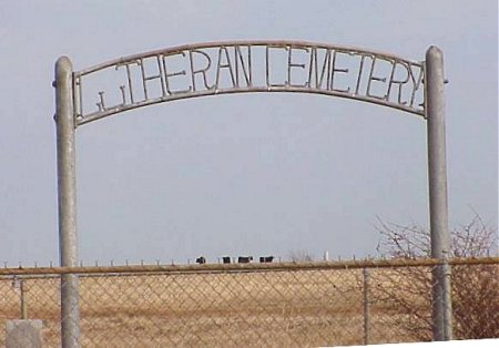 |
Mr. Erickson surveyed this cemetery in 1990. Mr. Lehr took a pictorial survey.
The cemetery is about 6 miles east of I-35 on HWY 33 (to the feed store) turn north about 200 yards and the cemetery sits on the right side.
There are other burials here that are unmarked, but there is no known plat map.
| BOHOT | Rosina | 08-23-1860 | 05-29-1905 | See photo |
| FLASCH | Joseph | 01-22-1871 | 08-23-1907 | See photo |
| FLASH | Maria Karner | 06-25-1848 | 06-27-1914 | See photo |
| GABER | Lena | 02-01-1871 | 01-06-1900 | Daughter See photo |
| KARNER | Johnny | 06-24-1902 | 03-26-1905 | See photo |
| MARQUARDT | Infant Son | 10-31-1910 | 10-31-1910 | Infant son of Carl See photo |
| MARQUARDT | Carl Edward | 03-15-1887 | 09-30-1958 | See photo |
| NIERMANN | Ernest | 05-17-1843 | 01-13-1913 | Father See photo |
| NIERMANN | Mary | 03-13-1847 | 12-05-1932 | Mother See photo |
This page was updated: Friday, 03-Dec-2021 16:10:40 EST
This site may be freely linked, but not duplicated in any way without consent.
All rights reserved! Commercial use of material within this site is prohibited!
The information on this site is provided free for the purpose of researching your genealogy. This material may be freely used by non-commercial entities, for your own research, as long as this message remains on all copied material. The information contained in this site may not be copied to any other site without written "snail-mail" permission. If you wish to have a copy of a donor's material, you must have their permission. All information found on these pages is under copyright of Oklahoma Cemeteries. This is to protect any and all information donated. The original submitter or source of the information will retain their copyright. Unless otherwise stated, any donated material is given to Oklahoma Cemeteries to make it available online. This material will always be available at no cost, it will always remain free to the researcher.
All rights reserved! Commercial use of material within this site is prohibited!
© 2000-2018 Oklahoma Cemeteries